All the Balearics in two weeks: Mallorca, Menorca, Ibiza, Formentera
Two weeks is what it takes to sail all four large Balearic islands without turning the holiday into a race. The loop of about 405 nm runs clockwise from Palma: Cabrera national park and Mallorca's east coast, the harbours of Mahón and Ciutadella on Menorca, Cap de Formentor and the Tramuntana cliffs, Ibiza's quiet north, Formentera, and back across open water to Palma. Between coastal days of 16–34 nm come four inter-island crossings of 34 to 58 nm, so this is a route for a crew that has done long passages before, with a day or two of weather margin in mind.
Day by day
Palma
- Palma39.565, 2.631
Boat handover on the Paseo Marítimo, fifteen minutes from the airport. Provisioning for the first days and a check of the Cabrera paperwork; over two weeks it pays to book the busiest stops in advance — Ciutadella, Sant Antoni and La Savina.
Palma → Cabrera
- Cabrera (Es Port)39.150, 2.932
- Colònia de Sant Jordimarina39.316, 2.998
Across the Bay of Palma past the Cap Blanc lighthouse, then five to six hours of open water to the archipelago. Night on a national-park buoy in the harbour of Es Port, below a 14th-century castle.
Cabrera → Portocolom
- Portocolom39.420, 3.263
Round Cap de ses Salines and along the calas of the south-east coast. Portocolom is a wide natural harbour with fishermen's boathouses; night on a buoy in the bay or alongside.
Portocolom → Cala Ratjada
- Cala Ratjada39.710, 3.464
- Porto Cristomarina39.540, 3.335
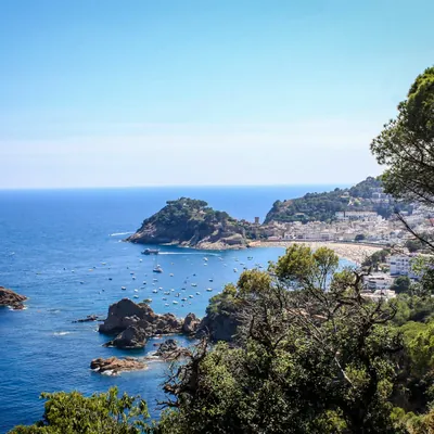
North along the east coast past Porto Cristo and the Caves of Drach. Cala Ratjada is a fishing port below the castle of Capdepera and Mallorca's last stop before the channel.
Cala Ratjada → Mahón (Menorca)
- Mahón39.887, 4.277
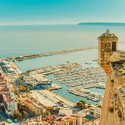
The crossing to Menorca, seven to eight hours of open water. In past the La Mola fortress into Mahón harbour, one of the longest natural harbours in the Mediterranean; night in a marina below the old town.
Mahón → Ciutadella
- Cala Macarella39.938, 3.937
- Ciutadella40.000, 3.833
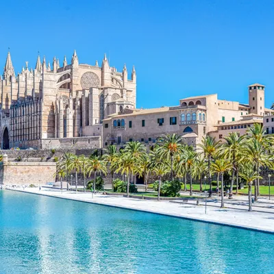
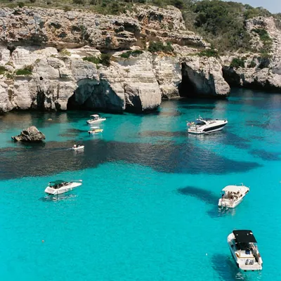
Along Menorca's south coast past Cala en Porter and Cala Galdana, with a lunchtime swim in turquoise Cala Macarella. Ciutadella is the island's old capital; you moor in a narrow canal-like harbour below the cathedral.
Ciutadella → Port de Pollença
- Port de Pollença39.907, 3.083
Back across the channel to Mallorca, five to six hours, with the Tramuntana mountains rising ahead. Night in the Bay of Pollença, the island's roomiest sheltered bay.
Pollença → Sóller
- Cap de Formentor39.962, 3.220
- Port de Sóller39.796, 2.693
Round the Formentor lighthouse and along the Tramuntana wall, with no shelter until Sóller. Port de Sóller is the only safe harbour on the north-west coast; an old wooden tram runs into town.
Sóller → Port d'Andratx
- Port d'Andratx39.543, 2.386
A short day along the Tramuntana past the Sa Foradada rock and through the channel by Dragonera island. Port d'Andratx is a former fishing harbour under the mountains; refuel and provision before Ibiza.
Andratx → Portinatx (Ibiza)
- Portinatx (Ibiza)39.112, 1.515
The crossing to Ibiza, seven to eight hours of open water to the south-west. Portinatx is a small cove on the island's quiet north coast, rarely crowded; night at anchor on sand.
Portinatx → Sant Antoni
- Sant Antoni (Ibiza)38.980, 1.300
Along Ibiza's wild north-west coast past the coves of Xarraca and Benirràs. The bay of Sant Antoni is known for its sunsets; night in the marina or at anchor in the bay.
Sant Antoni → La Savina (Formentera)
- Es Vedrà38.867, 1.200
- La Savina (Formentera)38.734, 1.416
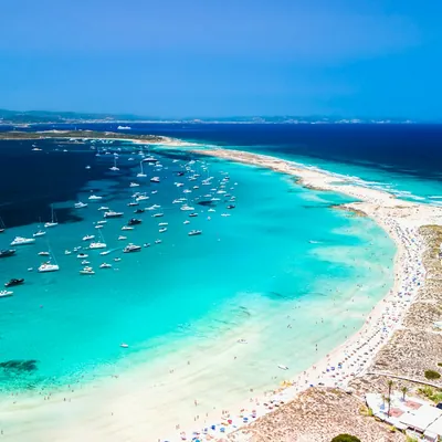
South past Cap de Cala Comte and the Es Vedrà rock, nearly 400 metres high, then on to Formentera. La Savina is the island's only marina; Formentera is easy to explore by bicycle, and Illetes beach is two miles away.
La Savina → Cala de Sant Vicent
- Cala de Sant Vicent39.074, 1.596
- Ibiza Townmarina38.913, 1.443
- Santa Eulàriamarina38.983, 1.539
North through the Es Freus strait, past the walls of Dalt Vila — Ibiza's old town and a UNESCO site — and up the east coast past Santa Eulària. Cala de Sant Vicent is a deep cove under the hills of the north-east; night at anchor, open to the east.
Sant Vicent → Palma
- Palma39.565, 2.631
The longest day: leave before dawn for nine to ten hours of open water to Mallorca, round Cap de Cala Figuera and into the Bay of Palma. Refuelling and handover.
Coordinates are approximate, for the harbour or bay. Paste them into Google Maps or a chartplotter, and check the chart and pilot book before you moor or anchor.
Good to know
- Weather: decide each of the four inter-island crossings in the morning on a fresh forecast; the main threat is the tramontana, a northerly that raises a steep sea in the Mallorca–Menorca channel within half a day. The last day is 58 nm; if its forecast is poor, cross to Mallorca a day early and drop one Ibiza stop: Cala de Sant Vicent to Port d'Andratx is about 46 nm, then 18 to Palma. The best months are May, June and September.
- Protected areas: Cabrera needs a navigation permit and a separate overnight buoy booking, both online; anchoring in the park is banned. Anchoring on posidonia is banned and fined throughout the Balearics — sand only; off Formentera, in the Ses Salines park, and in several Menorca bays there are summer buoy fields bookable online.
- Berths: in July and August book Mahón, Ciutadella, Sant Antoni and La Savina ahead; Ibiza and Formentera are the most expensive marinas on the route. Ciutadella harbour is occasionally hit by a 'rissaga', a sudden rise and fall of the water level of a metre or more; if one is announced, spend the night elsewhere.
- Logistics: over two weeks the crew can change halfway — Menorca and Ibiza airports are five to eight kilometres from Mahón and Ibiza town. Refuel before every inter-island crossing: there is fuel in Palma, Mahón, Sóller, Andratx, Sant Antoni and La Savina.
How to get to the marina
- Paseo Marítimo marinas, Palma de Mallorca
- Palma (PMI) — 12 km, 18 min by car
15–25 min · €22–35 per car
Taxi queue outside arrivals; about 12 km to the Paseo Marítimo marinas on the meter, airport supplement included.
15–25 min · €30–50 per car
Pre-booked transfer: the summer taxi queue can be long, while a booked driver waits in arrivals.
15–25 min · €20–50 per day
Rental desks in the terminal, cheap in autumn. Parking along Paseo Marítimo is tight, so return the car for the charter week.
30–50 min · €4–7 per person
EMT bus A1 every 15–20 minutes via Plaça d'Espanya to Passeig Mallorca near the seafront; then 10–20 minutes on foot or city bus L1 along Paseo Marítimo.
Ferries from Barcelona, Valencia and Dénia arrive at Palma's ferry terminal at the west end of Paseo Marítimo, 5–20 minutes by taxi from the marinas.
Prices are autumn 2026 estimates in euros; times are without traffic. Bus and ferry timetables change with the season, so check them before you travel.
When to go and what it costs in Spain
Median € per berth per week from the agent's latest check, monohulls; each month's page has both boat types, a chart and boats departing that month.
Discounted boats in Spain
All boats in Spain




How long is the Palma — Menorca — Ibiza route and where do you stay overnight?
14 days and about 406 nautical miles in a loop, starting and finishing in Palma. Overnight stops in order: Palma, Cabrera (Es Port), Portocolom, Cala Ratjada, Mahón, Ciutadella, Port de Pollença, Port de Sóller, Port d'Andratx, Portinatx (Ibiza), Sant Antoni (Ibiza), La Savina (Formentera), Cala de Sant Vicent. The longest leg is day 14, 58 nm.
How do I get to the marina for the Palma — Menorca — Ibiza route?
The route starts and finishes at Paseo Marítimo marinas, Palma de Mallorca. The nearest airport is Palma (PMI), 12 km away. Fastest: taxi, 15–25 min, €22–35 per car. Cheapest: bus, 30–50 min, €4–7 per person.
When is the best time to sail the Palma — Menorca — Ibiza route?
In the Balearics the season runs May to October. July and August are the peak: marinas are expensive and full, so you anchor or pick up a buoy. June and September bring warm water and lower prices; May and October are the shoulder months. In winter people sail in the Canaries, a separate area. By the agent's latest checks (monohulls), the cheapest month is October: a median of €260 per berth per week. The most expensive is January, at €300. The most boats with 20% off or more are in October: 45%. The agent checks the current month and the next five; each month has its own page with the numbers.
How much does a yacht for this route cost?
A whole boat in Spain for a week starts from €1,148 in the agent's current selection: the cheapest discounted week departing in the next three months. Prices per berth by month are higher up the page; the boats are under “All boats in Spain”.
Do I need a licence to charter a yacht?
For a bareboat charter (no skipper or crew provided), yes: a skipper's licence and, as a rule, a VHF radio certificate. Without a licence, we add a skipper, paid separately from the boat price.
What's included in the boat price?
Just the boat, for a week. Usually paid separately: transit log and final cleaning, fuel, marina fees, the security deposit (or deposit insurance), a skipper, cook and hostess if you need them, and extras (SUP board, on-board Wi-Fi, coffee machine, child safety netting).