Two weeks down the Lesser Antilles: St Martin to Martinique
The whole arc of the Lesser Antilles in two weeks: from French St Martin south through St Barths, St Kitts and Nevis, Antigua, Guadeloupe with Les Saintes, and Dominica to Le Marin on Martinique. The islands change every other day — a Swedish harbour, British forts, volcanoes and rainforest, Creole villages — and most legs run across the trade wind, the best point of sail. About 325 nm one way, with four legs of 40–55 nm over open water; you pick up the boat in Anse Marcel and hand it back in Le Marin.
Day by day
Marina Anse Marcel
- Anse Marcel18.114, -63.037
Take over the yacht after 17:00 at Anse Marcel marina, an enclosed basin in a green bay on the north coast of St Martin, 40 minutes from Princess Juliana airport. Provision on the way from the airport, at the supermarkets of Marigot or Grand Case. At the briefing, ask which papers the fleet prepares for foreign waters and where to clear at each change of flag.
Anse Marcel → Îlet Pinel → Gustavia
- Îlet Pinel18.104, -63.012
- Gustavia17.897, -62.851
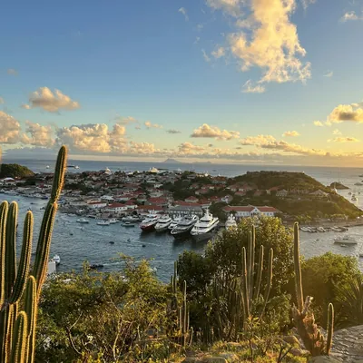
A morning at Îlet Pinel in the nature reserve off St Martin's east coast — a beach, moorings and little restaurants by the water. Then three hours south-east past Tintamarre across the channel to St Barths. Clear in at the Gustavia port office; spend the evening in the red-roofed harbour with its Swedish past.
Gustavia → White House Bay, St Kitts
- White House Bay, St Kitts17.248, -62.660
- Christophe Harbourmarina17.245, -62.656
An early start and a day south with the trade wind on the beam, past the volcanic cone of St Eustatius to St Kitts. White House Bay is a quiet bay on the island's south-eastern peninsula; you clear into St Kitts and Nevis at neighbouring Christophe Harbour marina (in season, November to May) or in Basseterre.
White House Bay → Charlestown, Nevis
- Charlestown, Nevis17.142, -62.628
Through The Narrows, the shallow strait between the islands — by day only and strictly by the chart. On Nevis the port authority assigns the moorings: call them on channel 16 as soon as you arrive. Charlestown has a museum in the house where Alexander Hamilton was born, and Nevis Peak stands in its cloud above the island. Clear out of the country here too.
Charlestown → English Harbour, Antigua
- English Harbour17.006, -61.764
The hardest leg of the route: 50 nm east, almost straight into the trade wind. Leave at first light and expect most of it under engine or on long tacks. By evening, English Harbour and Nelson's Dockyard, the Georgian naval base now a UNESCO site; clear into Antigua at the customs office in the dockyard.
English Harbour → Nonsuch Bay
- Nonsuch Bay (Green Island)17.070, -61.672
A morning at the dockyard and in neighbouring Falmouth Harbour; clear out of Antigua in advance at English Harbour and ask customs how long the clearance is valid. Then up the windward coast behind the reef into Nonsuch Bay and Green Island: turquoise water, kitesurfers on the flats and the trade wind blowing across an anchorage with no sea.
Nonsuch Bay → Deshaies, Guadeloupe
- Deshaies16.307, -61.798
Eight hours south with the trade wind on the beam — a fast passage over open water, with volcanic Montserrat on the horizon to starboard. Deshaies is a village around its church in a bay on the north-west of Basse-Terre, with gusts falling into the bay from the mountainsides. Clear into France at the terminal in the village; the botanical garden is above it.
Deshaies → Malendure (Pigeon Islands)
- Malendure (Pigeon Islands)16.166, -61.782
A short hop south to the Cousteau Reserve around the Pigeon Islands, one of the finest coral gardens in the Antilles. The islands themselves are a protected zone, so the yacht anchors off Malendure beach opposite, and you reach the reef by dinghy. In the evening, sunset over the islands.
Malendure → Les Saintes
- Les Saintes (Terre-de-Haut)15.871, -61.587
- Marina de Rivière-Sensmarina15.983, -61.716
South along the lee coast of Basse-Terre under La Soufrière volcano, where the wind close inshore is fickle, round the southern tip of Guadeloupe and across the channel to Les Saintes. In the bay off the village on Terre-de-Haut you lie on paid moorings; in the evening, walk up to Fort Napoléon.
Les Saintes → Portsmouth, Dominica
- Portsmouth, Dominica15.578, -61.465
Three to four hours south across the Dominica channel into Prince Rupert Bay. The PAYS boats will give you a mooring and help with customs: in Dominica you clear in and out in one visit. After lunch, up the Indian River in a rowing boat with a guide — engines are banned on the river.
Portsmouth → Saint-Pierre, Martinique
- Saint-Pierre14.742, -61.182
- Roseaumooring buoys15.293, -61.392
A long day: south along the whole of Dominica, where the wind under the mountains dies and then hits in squalls, and across the Martinique channel to Saint-Pierre. The town was the island's capital until the 1902 eruption of Mount Pelée destroyed it within minutes; among the ruins is the cell in which a prisoner survived. Clear into France at the terminal in the village. If the wind is fresh, split the leg with a night on a mooring in Roseau.
Saint-Pierre → Anse Mitan
- Anse Mitan14.551, -61.058
Three hours south along the coast to the Bay of Fort-de-France. Anse Mitan by Pointe du Bout has a beach, restaurants and boats across the bay to Fort-de-France, the island's capital, with its market and the Schœlcher Library.
Anse Mitan → Grande Anse d'Arlet → Sainte-Anne
- Grande Anse d'Arlet14.502, -61.089
- Diamond Rock14.441, -61.042
- Sainte-Anne14.440, -60.886
Lunch at Grande Anse d'Arlet, where turtles graze the seagrass off the beach; you may only anchor in the permitted zone. Then past Diamond Rock and east along the south coast to Sainte-Anne, a roomy anchorage on sand off a village with a white church.
Sainte-Anne → Le Marin
- Le Marin14.468, -60.868
Half an hour across the bay to Marina du Marin: fuel and handover. A night aboard in the marina, flight home the next day.
Coordinates are approximate, for the harbour or bay. Paste them into Google Maps or a chartplotter, and check the chart and pilot book before you moor or anchor.
Good to know
- Season and weather: December to April, at its best from January to March; the trade wind blows from the east and north-east at 15–20 knots, up to 25 in December and January. June to November is hurricane season. Most of the route runs across the trade wind, but three legs of 40–55 nm cross open water, and Nevis to Antigua is almost dead to windward: keep a spare day and sit out 25 knots.
- Formalities: every change of flag means clearing: into St Barths at Gustavia; into St Kitts and Nevis at Christophe Harbour or Basseterre and out at Charlestown; in and out of Antigua at English Harbour; into Guadeloupe at Deshaies; in and out of Dominica in one visit at Portsmouth; into Martinique at Saint-Pierre. Many of the islands accept advance declarations through SailClear, which saves time at the counter. The fleet must allow you into all these waters — ask when booking.
- Moorings and parks: on Nevis the port authority assigns moorings on channel 16; English Harbour is a national park with a park fee; the Pigeon Islands are the protected zone of the Cousteau Reserve; Les Saintes has paid moorings only; at Grande Anse d'Arlet you may anchor only in the permitted zone. PAYS moorings in Portsmouth are paid, and in 2025 there were complaints about their reliability — check yours.
- One way and home: the fleet charges a one-way fee for taking the boat from St Martin to Martinique — it depends on the boat and the season, so ask when booking; only companies with bases on both islands offer this route. You hand the boat back at Marina du Marin; Martinique airport (FDF) is 35 km away, about 45 minutes by taxi, with direct flights to and from Paris.
How to get to the marina
- Marina d'Anse Marcel (Port de Lonvilliers), St Martin
- Sint Maarten (Princess Juliana) (SXM) — 24 km, 40 min by carGrand Case (regional flights) (SFG) — 6 km, 12 min by car
10–15 min · €20–30 per car
From the small Grand Case airport, a taxi from the rank by the terminal over the hill to Anse Marcel at the French side's fixed tariff.
35–55 min · €45–70 per car
The taxi dispatcher at the exit gives a fixed price; the road runs along the lagoon via Marigot and Grand Case, with jams near Marigot at rush hour. Extra per passenger beyond two and at night.
35–55 min · €60–90 per car
A pre-booked transfer: a driver with a sign in arrivals and a fixed price per car. Handy for a group with lots of luggage.
35–55 min · €35–55 per day
Rental desks at the airport. Driving is on the right and you cross between the Dutch and French sides without stopping; there are supermarkets on the way for provisioning.
Planes land at SXM right over Maho Beach; there are direct flights from Paris, Amsterdam and the US. The border between the French and Dutch halves of the island is open.
Prices are autumn 2026 estimates in euros; times are without traffic. Bus and ferry timetables change with the season, so check them before you travel.
When to go and what it costs in the Caribbean
Median € per berth per week from the agent's latest check, monohulls; each month's page has both boat types, a chart and boats departing that month.
Discounted boats in the Caribbean
All boats in the Caribbean




How long is the St Martin — Martinique route and where do you stay overnight?
14 days and about 325 nautical miles one way, starting in St Martin and handing the boat back in Martinique. Overnight stops in order: Anse Marcel, Gustavia, White House Bay, St Kitts, Charlestown, Nevis, English Harbour, Nonsuch Bay (Green Island), Deshaies, Malendure (Pigeon Islands), Les Saintes (Terre-de-Haut), Portsmouth, Dominica, Saint-Pierre, Anse Mitan, Sainte-Anne. The longest leg is day 11, 55 nm.
How do I get to the marina for the St Martin — Martinique route?
The route starts and finishes at Marina d'Anse Marcel (Port de Lonvilliers), St Martin. The nearest airport is Sint Maarten (Princess Juliana) (SXM), 24 km away. Fastest: taxi, 10–15 min, €20–30 per car.
When is the best time to sail the St Martin — Martinique route?
The Caribbean season runs December to April: dry, with a steady 15–20-knot trade wind. The most expensive weeks are Christmas, New Year and February–March. June to November is hurricane season: boats are cheaper, the weather riskier; May is a transition month. The fleet is mostly catamarans, booked 4–8 months ahead. By the agent's latest checks (monohulls), the cheapest month is October: a median of €510 per berth per week. The most expensive is February, at €787. The most boats with 20% off or more are in November: 11%. The agent checks the current month and the next five; each month has its own page with the numbers.
How much does a yacht for this route cost?
A whole boat in the Caribbean for a week starts from €1,790 in the agent's current selection: the cheapest discounted week departing in the next three months. Prices per berth by month are higher up the page; the boats are under “All boats in the Caribbean”.
Do I need a licence to charter a yacht?
For a bareboat charter (no skipper or crew provided), yes: a skipper's licence and, as a rule, a VHF radio certificate. Without a licence, we add a skipper, paid separately from the boat price.
What's included in the boat price?
Just the boat, for a week. Usually paid separately: transit log and final cleaning, fuel, marina fees, the security deposit (or deposit insurance), a skipper, cook and hostess if you need them, and extras (SUP board, on-board Wi-Fi, coffee machine, child safety netting).