The Bay of Kotor in five days
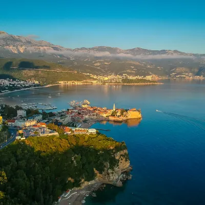
The Bay of Kotor is the only bay of its shape on the Adriatic: three basins joined by narrow straits, mountains straight out of the water, and legs that rarely take more than two hours. It is a route for those with less than a week or sailing with family: no need to go far, there is always shelter, and every evening you are in a town with a history.
Day by day
Tivat
- Tivat42.434, 18.689
Boat handover at Porto Montenegro, provisioning in town. If there is time left — a short hop out to anchor in the bay opposite.
Tivat → Herceg Novi
- Herceg Novi42.451, 18.535
- Portonovimarina42.434, 18.603
Down towards the mouth of the bay past Kamenari. Herceg Novi is a staircase of a town on the hillside, with an old fortress above the waterfront.
Herceg Novi → Žanjice
- Žanjice42.400, 18.566
- Rosemooring buoys42.430, 18.558
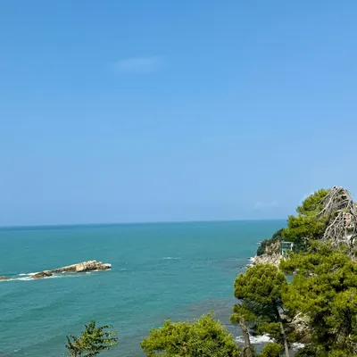
A bay right at the entrance to the gulf, opposite the fortress island of Mamula. The water here is noticeably clearer than deep inside the Boka.
Žanjice → Perast
- Perast42.486, 18.698
- Risantown quay42.513, 18.695
Back into the bay through the Verige strait. Opposite Perast — the man-made islet of Our Lady of the Rocks with its church.
Perast → Kotor → Tivat
- Kotor42.425, 18.768
- Tivat42.434, 18.689
- Prčanjtown quay42.453, 18.749
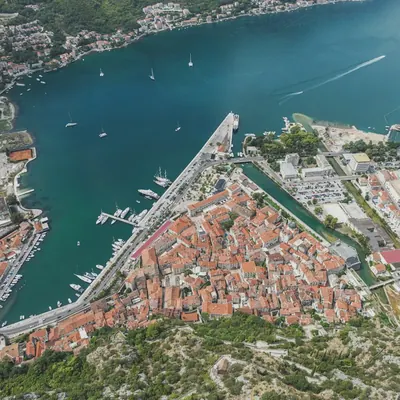
Kotor at the head of the bay: an old town under the fortress walls, a UNESCO site. Back to Tivat by evening and handover.
Coordinates are approximate, for the harbour or bay. Paste them into Google Maps or a chartplotter, and check the chart and pilot book before you moor or anchor.
Good to know
- The bay is enclosed: almost no swell, and the wind only picks up in the straits. The season is longer than at sea — the Boka is sailable from April to October.
- Legs are short, 1–2 hours, so the route fits into five days. The remaining days usually go on the climb to Kotor fortress and on the Luštica peninsula.
- Formalities: entering Croatia from the Boka needs separate border clearance — on a short route it rarely makes sense.
How to get to the marina
- Porto Montenegro, Tivat
- Tivat (TIV) — 4 km, 10 min by carPodgorica (TGD) — 85 km, 1.5 h by carDubrovnik (Croatia) (DBV) — 60 km, 1.5 h by car
10–15 min · €10–15 per car
Taxi outside the terminal — 4 km to Porto Montenegro, about 10 minutes. Confirm the fare before you get in.
10–15 min · €25–50 per day
Rental desks at Tivat airport. Handy before or after the charter — during the week the car sits in a paid car park.
30–50 min · €2–4 per person
Intercity buses on the Kotor–Budva road stop on request by the airport. Ride to Tivat bus station, then walk 15–20 minutes to the marina.
1.5 h · €75–85 per car
Podgorica airport taxi at a fixed fare — €80 to Tivat, via Cetinje and Budva.
1.5–2.5 h · €120–200 per car
Pre-booked transfer from Dubrovnik, crossing the Croatia–Montenegro border (Karasovići–Debeli Brijeg) and the Kamenari–Lepetane car ferry across the bay.
2.5–4 h · €9–14 per person
Airport bus to Podgorica bus station, then an intercity bus to Tivat via Budva — several departures a day.
4–5.5 h · €30–45 per person
Airport shuttle to Dubrovnik bus station, then a bus to Kotor or Tivat — a couple of departures a day, 2–2.5 hours with the border.
From Dubrovnik allow time for the border: summer queues can reach 1–2 hours. The Kamenari–Lepetane ferry (about 10 minutes) saves the drive round the bay; Kotor is 20–30 minutes from Tivat by bus.
Prices are autumn 2026 estimates in euros; times are without traffic. Bus and ferry timetables change with the season, so check them before you travel.
When to go and what it costs in Montenegro
Median € per berth per week from the agent's latest check, monohulls; each month's page has both boat types, a chart and boats departing that month.
Discounted boats in Montenegro
All boats in Montenegro



How long is the Tivat — Kotor route and where do you stay overnight?
5 days and about 62 nautical miles in a loop, starting and finishing in Tivat. Overnight stops in order: Tivat, Herceg Novi, Žanjice, Perast. The longest leg is day 4, 16 nm.
How do I get to the marina for the Tivat — Kotor route?
The route starts and finishes at Porto Montenegro, Tivat. The nearest airport is Tivat (TIV), 4 km away. Fastest: taxi, 10–15 min, €10–15 per car. Cheapest: bus, 30–50 min, €2–4 per person.
When is the best time to sail the Tivat — Kotor route?
Montenegro's season runs May to October. July and August are the peak; in June and September the sea is warm and the weather settled; May and October are the shoulder months, with cheaper boats. The cruising area is compact, so a week works at either end of the season too. By the agent's latest checks (monohulls), the cheapest month is December: a median of €230 per berth per week. The most expensive is October, at €253. The most boats with 20% off or more are in October: 12%. The agent checks the current month and the next five; each month has its own page with the numbers.
How much does a yacht for this route cost?
A whole boat in Montenegro for a week starts from €1,138 in the agent's current selection: the cheapest discounted week departing in the next three months. Prices per berth by month are higher up the page; the boats are under “All boats in Montenegro”.
Do I need a licence to charter a yacht?
For a bareboat charter (no skipper or crew provided), yes: a skipper's licence and, as a rule, a VHF radio certificate. Without a licence, we add a skipper, paid separately from the boat price.
What's included in the boat price?
Just the boat, for a week. Usually paid separately: transit log and final cleaning, fuel, marina fees, the security deposit (or deposit insurance), a skipper, cook and hostess if you need them, and extras (SUP board, on-board Wi-Fi, coffee machine, child safety netting).