From Athens to Thessaloniki via Evia and the Sporades
A one-way route from the south to the north of the Aegean: from the Saronic Gulf via Andros, the east coast of Evia and the Sporades to Halkidiki and Thessaloniki. This is a passage, not a holiday in the bays: about 306 nm in nine sailing days, four legs over 35 nm and several stretches of open sea with no shelter. In return, every evening brings a new island, and the waters north of Evia see few charter boats. A route for an experienced crew, best in June or September when the meltemi is weaker.
Day by day
Alimos (Athens)
- Alimos37.910, 23.708
Handover after 17:00. The return in Thessaloniki must be agreed in the contract beforehand — without it the fleet will not release the boat one way. Provisioning and a night on the pontoon.
Alimos → Aegina
- Aegina37.746, 23.427
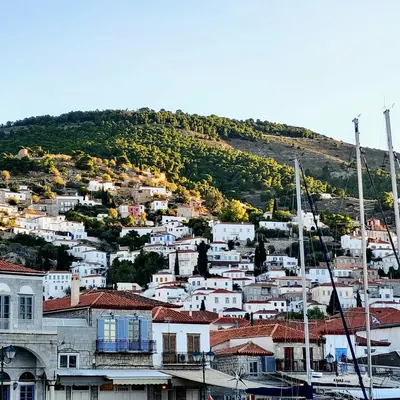
A short warm-up leg across the gulf. Aegina: a horseshoe harbour, pistachios on the waterfront and the Temple of Aphaia on the hill.
Aegina → Lavrion
- Cape Sounion37.643, 24.030
- Lavrion (Olympic Marine)37.697, 24.060
East past Cape Sounion and its Temple of Poseidon, then up the Attica coast. Lavrion is a charter port with the Olympic Marine marina: the last big shop and fuel stop before the northern part of the route.
Lavrion → Andros (Gavrio)
- Gavrio (Andros)37.885, 24.735
- Batsi (Andros)town quay37.855, 24.785
East across the Kea Channel to Andros. Gavrio is the ferry port on the west coast, with yachts on the town quay; the resort of Batsi is three miles south.
Andros → Evia (Agioi Apostoloi)
- Kafireas Strait (Cavo Doro)37.982, 24.620
- Agioi Apostoloi (Evia)38.409, 24.197
The key day of the route: the Kafireas Strait (Cavo Doro) between Andros and Evia, where the meltemi is noticeably stronger than around it, then north-west along the east coast of Evia. Agioi Apostoloi is a fishing harbour behind a breakwater, one of the few shelters on this coast.
Evia → Skyros (Linaria)
- Linaria (Skyros)38.843, 24.537
An open-sea leg to the north-east. Linaria is the main port of Skyros, in a bay on the west coast; the Chora with its castle and monastery is on the other side of the island, reached by bus.
Skyros → Alonissos (Gerakas)
- Gerakas (Alonissos)39.272, 23.947
- Steni Vala (Alonissos)town quay39.190, 23.927
Open sea again, north-west to the Sporades. Gerakas is a narrow bay at the northern tip of Alonissos on the edge of the national marine park; it is open to the north-east, so stay the night only on a settled forecast. In the meltemi use Steni Vala on the east coast, 7 nm further south.
Alonissos → Halkidiki (Nea Skioni)
- Nea Skioni (Kassandra)39.945, 23.528
The longest leg: open sea to the Kassandra peninsula. Leave at dawn and by evening you are in Nea Skioni, a small harbour behind a breakwater on the south-west coast of Kassandra, open to northerly winds.
Nea Skioni → Nea Kallikratia
- Nea Kallikratia40.309, 23.058
- Sani Marina (Kassandra)marina40.098, 23.311
North along the west coast of Kassandra and across the bay to mainland Halkidiki. Nea Kallikratia is a resort town with a harbour and a long promenade.
Nea Kallikratia → Thessaloniki (Aretsou)
- Aretsou Marina (Thessaloniki)40.574, 22.946
- Nea Michanionatown quay40.461, 22.858
Past Cape Megalo Emvolo into the Thermaic Gulf. Aretsou marina in Kalamaria is where you hand the boat back; Thessaloniki airport is about 20 minutes away by taxi.
Coordinates are approximate, for the harbour or bay. Paste them into Google Maps or a chartplotter, and check the chart and pilot book before you moor or anchor.
Good to know
- One way: not every company lets a boat go one way, and the fee for returning it to another marina is agreed when booking and can be substantial. Home from Thessaloniki is via the city's airport, about 20 minutes by taxi from Aretsou marina.
- Long legs: the Kafireas Strait, Evia to Skyros, Skyros to Alonissos and Alonissos to Kassandra all cross open sea with no shelter on the way. Leave at dawn and only on a forecast of up to 20–25 knots; in a north-easterly the east coast of Evia is a lee shore with few harbours.
- Marine park: Gerakas sits on the edge of the National Marine Park of Alonissos and the Northern Sporades. The strictly protected area around the island of Piperi is closed to boats, and around Kyra Panagia and Gioura there are anchoring restrictions and a paid permit may be required — check the current rules before you go.
- Wind and season: in July and August the meltemi blows from the north and north-east, so much of the route is close-hauled; June and September are noticeably calmer. The Thermaic Gulf sometimes gets the vardaris, a cold northerly out of the Axios valley, more often in autumn.
How to get to the marina
- Alimos Marina, Athens
- Athens (ATH) — 37 km, 40 min by car
35–60 min · €40–60 per car
Taxi rank right outside arrivals; metered ride via Attiki Odos and the coast road. Night tariff from midnight to 5 am costs more.
35–60 min · €45–70 per car
Driver meets you with a name sign in arrivals and drops you at the pier; price fixed when booking. A 6–8 seat minivan is about €70–90.
35–60 min · €30–60 per day
Rental desks in the arrivals hall. Only worth it for the drive itself: the marina car park is paid and the car sits idle during the cruise.
1–1.5 h · €6 per person
Express bus X96 "Airport – Piraeus" runs 24/7 every 20–40 minutes; get off at the Poseidonos Avenue stops by Alimos Marina. Buy the ticket at the kiosk or machine by the stop and validate it on board.
1.5–2 h · €9–11 per person
Metro line 3 to Syntagma, then tram T6 to Pikrodafni and T7 a couple of stops along the coast to Alimos Marina. Awkward with big bags, but no traffic.
The X96 is the only public transport from the airport that also runs at night — handy if you land after midnight.
Prices are autumn 2026 estimates in euros; times are without traffic. Bus and ferry timetables change with the season, so check them before you travel.
When to go and what it costs in Greece
Median € per berth per week from the agent's latest check, monohulls; each month's page has both boat types, a chart and boats departing that month.
Discounted boats in Greece
All boats in Greece




How long is the Athens — Thessaloniki route and where do you stay overnight?
10 days and about 306 nautical miles one way, starting in Athens and handing the boat back in Thessaloniki. Overnight stops in order: Alimos, Aegina, Lavrion (Olympic Marine), Gavrio (Andros), Agioi Apostoloi (Evia), Linaria (Skyros), Gerakas (Alonissos), Nea Skioni (Kassandra), Nea Kallikratia. The longest leg is day 8, 46 nm.
How do I get to the marina for the Athens — Thessaloniki route?
The route starts and finishes at Alimos Marina, Athens. The nearest airport is Athens (ATH), 37 km away. Fastest: taxi, 35–60 min, €40–60 per car. Cheapest: bus, 1–1.5 h, €6 per person.
When is the best time to sail the Athens — Thessaloniki route?
Greece's season runs April to October. In July–August the meltemi blows 25–30 knots in the Cyclades and the Dodecanese, so beginners are better off in the Ionian or the Saronic Gulf in those months. June and September bring warm water, gentler wind and prices below the peak; April, May and October are the shoulder months and the cheapest weeks of the season. By the agent's latest checks (monohulls), the cheapest month is March: a median of ≈€237 per berth per week. The most expensive is December, at ≈€283. The most boats with 20% off or more are in October: 39%. The agent checks the current month and the next five; each month has its own page with the numbers.
How much does a yacht for this route cost?
A whole boat in Greece for a week starts from €945 in the agent's current selection: the cheapest discounted week departing in the next three months. Prices per berth by month are higher up the page; the boats are under “All boats in Greece”.
Do I need a licence to charter a yacht?
For a bareboat charter (no skipper or crew provided), yes: a skipper's licence and, as a rule, a VHF radio certificate. Without a licence, we add a skipper, paid separately from the boat price.
What's included in the boat price?
Just the boat, for a week. Usually paid separately: transit log and final cleaning, fuel, marina fees, the security deposit (or deposit insurance), a skipper, cook and hostess if you need them, and extras (SUP board, on-board Wi-Fi, coffee machine, child safety netting).